This is the beginning of a collection - with much
more to find....
|
Click on a picture for a more detailed
image or a web site
|
|
Some of these will take a while
to open so as to show the detail
|
| |
|
|
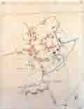
| 1839 Tithe map - the Tithes
are shown below |
|
 |
|
|
|
|
|
| Link to Further tithe info from Dorset Coast Digital Archive |
|
|
|
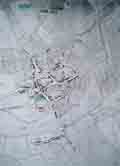
This map of 1903 shows the old quarries and field names for all
fields in the village
The annotations were made by Maurice Ouseley who was a historian
& local expert
|
|
 |
|
|
|
| 1923 map |
|
 |
|
|
|
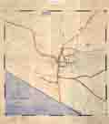
| Old Tithe map courtesy of
Bridport Museum - year unknown |
|
 |
|
|
|
|
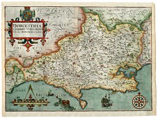
This web site has a number of old maps for Dorsetshire and many
of the
towns in Dorset - dates of maps seem to be from the 17th Century
|
|
 |
|
|
|
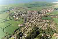
Aerial view of the village believed to be taken in about 1993 possibly by Airpic |
|
 |
|
|
|
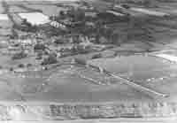
Old aerial photo of the village from 1953
(source unknown at this time) |
|
 |
|
|
|
|
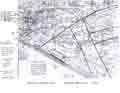
Old Ordnance Survey map of 1891 showing the quarries
(Enter Burton Bradstock in THEIR search box)
|
|
Click
here |
|
|
|
| Walking, Running, Cycling Maps for the Great Outdoors |
|
OS Maps |
|
|
|
| The Dorset History Centre in Dorchester holds
many old documents and maps in their archives |
|
click here |
|
|
|

