The Geology and Building Stones of Burton Bradstock: Jo Thomas, September, 2000.
The building stones used in Burton Bradstock come almost entirely from within the parish. All the stones used are Jurassic (about 180 million years old) and were formed as sediments of clay, sand or lime mud under a shallow sea on a continental shelf.
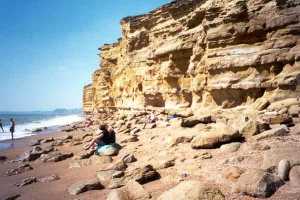
The cliffs at Burton Bradstock show three contrasting profiles. On the west the golden yellow Bridport Sands were formed as a huge sandbank. Hard bands were created occasionally when the top of the sandbank was in such shallow water that the lime precipitating from seawater in the subtropical climate cemented the grains together. As conditions changed sea level remained shallow for a long time, possibly up to 8 million years, and several different beds of limestone formed. These are known as Inferior Oolite Limestone, and can be seen at the top of the cliff. The lower beds are too sandy and the middle ones too full of fossils to use as building stone, but the top limestones were quarried on the slope of the hill at Southover. A small patch of the lowest Fuller’s Earth clay tops the cliff near Freshwater.
| West Cliff | Sequence of rocks on the coast near Burton Bradstock | East Cliff |
 |
 |
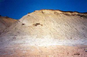 |
The eastern cliff shows the upper part of the Fuller’s Earth Clay. The whole sequence of lime-rich clay formed in deeper water. As more continental movement caused sea level to fluctuate, the character of the clay changed and occasional banks of broken shells formed in shallower water. These shell-banks have become the Forest Marble limestone that has been quarried on North Hill and on Cogden Farm.
The sides of Cliff Hill show a cut through the Inferior Oolite and are a Site of Special Scientific Interest.
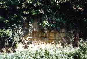 |
On Cliff Hill the Top Limestones are hidden by vegetation in the summer. |
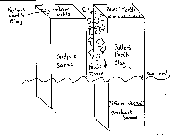
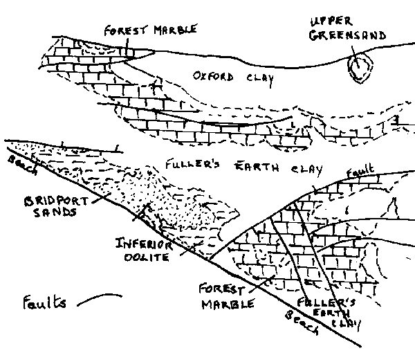
The Jurassic rocks of the Bridport area were subject to enormous pressure during the movement of continents about 140 million years ago. Large sections broke away and moved sideways or vertically along faults. As the blocks moved, the edges broke into small pieces that were dragged along in the fault zone. When this phase of movement ceased, the broken pieces were cemented together by later sediments. The central part of Burton beach is a fault zone, and forms a weak point in the shoreline. The fault can be traced north eastwards because Larkfield was a quarry in the Inferior Oolite on the west of the fault, and along the Bredy road is a quarry in the Forest Marble, on the east of the fault.
The fault and the structure of rocks inland are illustrated below:
 |
 |
|
Difference across the fault line
|
Sketch map of outcrops of Middle Jurassic
at Burton Bradstock (with apologies to British Geological Survey).
|
Looking north from the west cliff top, the village is built on Fuller’s Earth Clay over the Inferior Oolite, the lower slopes of North Hill are the remainder of the Fuller’s Earth Clay, and the top is capped by the Forest Marble limestone. Old maps show some of the quarries where the stone was extracted from North Hill and the long redundant workings can still be seen today.
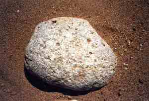 |
| Large Forest Marble
cobbles can be found on the eastern beach. |
The Bride river has cut a valley into the soft clay.
Both the Inferior Oolite and the Forest Marble have been used in the village buildings. As Forest Marble is a stronger limestone, in which calcium carbonate (lime) from dissolved shells has recrystallised to cement together the remaining broken shells, it is used as a foundation and damp-proof course even when the remaining walls are of the Inferior Oolite. Examples of building stone used in the village are shown below:
| Cottage built of a mix of Inferior Oolite and Forest Marble | 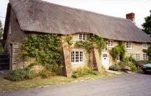 |
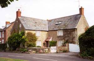 |
The White House is built of Forest Marble, with Inferior Oolite quoins. |
| Cottage almost entirely of Inferior Oolite | 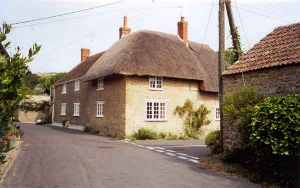 |
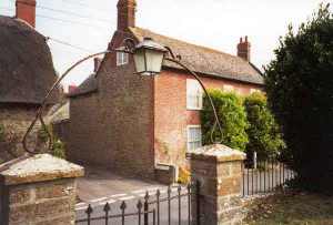 |
An older house of Forest Marble has an 18th century brick front. The bricks may have been made from Oxford Clay in Bothenhampton, or from Down Cliff Clay at Allington |
| .Mill Cottages have Forest Marble in the lower part of the wall and Inferior Oolite above that must have come from the excavated land on which they are built | 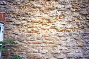 |
About Jo Thomas
Mrs. JO Thomas of Broadstone kindly put together this article on the geology and building stones of the village. JO is Secretary to Dorset's Important Geological Sites group, which includes the Dorset Geologists' Association group, Dorset Environmental Records Centre (DERC) http://www.derc.org.uk, the Dorset Wildlife Trust http://www.wildlifetrust.org.uk/dorset, the Dorset County Museum, English Nature, and representatives of the District and County Councils http://www.dorset-cc.gov.uk. She claims to be an enthusiastic amateur but her knowledge seems to have no limits!Author: JO Thomas - September, 2000
Text and photographs - © Copyright JO Thomas
References: Proceedings of the Dorset Natural History and Archaeological Society, Volume 116 for 1994 - part 3.